
Randy Helzer
Active Member
I was going through old pictures last night (Covid therapy), and found these. I thought they might be of interest since they were all taken when the lake was near full or in one case over full.
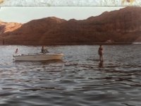
The first one is of me standing on the huge mound that is currently an island in the middle of the Escalante about 4 miles up from the mouth. It was about 6” under water. This was taken in July of 1983 at an elevation near 3704.
The second is of the Dam at 3695, probably around 1992
The third is of the bridge just north of Hite, probably around 1992.


")


