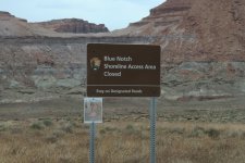
This is the kind of confusion I was talking about earlier. The closure isnt about fragile western landscapes or hundred year old tracks. Not that those are not worth discussing, they are. This is below high water. There isnt any hundred year fragility left there anymore.
All a very interesting discussion.
The head-scratching part of this for me is what is the significance of the 3670 lake level to mark the closure point in the road? There's at least some logic to a benchmark of 3700 as the high water mark of the lake. That being said, there's lots of examples around the lake where controlled access is already allowed below 3700 (and even 3670), notably at the marinas. Some of the improvements below 3700/3670 are extensive, parking areas being a notable example, such as at Bullfrog.
On the flip side, you can argue that roads should be open all the way to the lake, whatever the current shoreline might be. The problem there is that in places like Blue Notch, any former road in the zone closest to the lake might be difficult to follow because the re-contouring done by the lake over the years, leading to multiple tracks being created in that dynamic area in order to reach the lake.
So again, why 3670? It feels arbitrary, or at least not well-explained. And of course, the last thing anybody likes or trusts are arbitrary rules, especially ones that can't be explained. That's usually a surefire formula for deliberate violation, which leads to other problems...
Digging back into the charts that trace the history of lake levels at Powell in search of a possible solution, here's what you learn. From 1963-1999, the surface of Lake Powell exceeded 3670 a little over 40% of the time. In other words, it was always plausible that in short order, it might actually reach full pool. But since then, drought has characterized the region. In the 21st century, the lake has only exceeded 3670 a little over 1% of the time--only 116 days total. The last time it reached 3670 was on July 27, 2001, nearly a quarter century ago. It's reasonable to guess that the entire staff at NPS responsible for managing the GCNRA has turned over since that time, and that nobody there now has any institutional memory of a time when the lake might be that full. It's not something they consider to be realistic. It's quite possible that, even as the lake has continued to drop and trends remain pointing downward, they've come to the conclusion it will likely never reach that level again. And for that reason, they feel comfortable keeping the road open down to the 3670 level, especially if it aligns with the settlement with regard to SUWA's recent lawsuit.
Now of course this is all speculation on my part, but it's a narrative that at least seems plausible. Whether or not it's an effective management strategy is another discussion. As others have pointed out, the most important aspect of minimizing damage to lands above the lakeshore (however you define "lakeshore") is to make sure vehicles remain on the authorized access road rather than scatter indiscriminately across the desert. As for the area between where the lake is now and 3670, I'm guessing this no-man's land is now seen by many as a land in restoration, an area where the lake will become increasingly unlikely to encroach, so the management goal is to leave it alone as much as possible. Hence the road closure. And yet, they know they need to maintain access to the lake, but they don't want to commit to creating a defined roadway through the unstable area. In that context, allowing folks to reach the shore to unload (on what path?) is a sort of awkward but necessary compromise, but not particularly effective as a restoration strategy, if that's really the goal. Better signage with clear instructions at the "closure" point would be helpful to everyone. As it is, it's a sort of road closure with a wink and a nod, an approach seemingly designed to sow the seeds of anger and confusion on the part of everyone...
The more hopeful among us may disagree with the assessment that the lake is unlikely to ever fully rebound, and that the lake may someday return to full pool, but the data of the past quarter century is compelling, and until we see a definite turnaround in that long-term trend (i.e., something like at least three well above average snow years in a row, something that last occurred from 1997-99), planning for the restoration of the upper portions of what used to be Lake Powell is at least logical to consider...