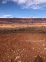
…and speaking of defunct marinas, here’s the San Juan Marina. This first photo was originally posted by
@PowellBride …
View attachment 26664
The next shot shows the location of the marina as depicted on the Lake Powell Boating Charts by Steve and Gail Brown (1990). Although they only show the lake at 3600 and 3700 they are still my “go to” maps when planning a trip, beautifully drawn and a big step up from the Stan Jones map in detail… unfortunately long out of print… if you can find a copy, it’s worth picking up…
By the way, to give you some idea how much silt has been deposited in the San Juan in the past 30 years, take a look at the map below. The dark blue area is the lake at 3600, at least what it would have been in 1990--basically just downstream of the marina, and upstream of Mikes Canyon. In a 2018 aerial taken when the lake was at 3601, the lake ended in the middle of the Great Bend, about 20 miles downstream from this location... wow... a lot of silt...
View attachment 26665
The next shot is a nice detailed drawing of the marina from another out of print mapbook, called the Lake Powell Boater’s Guide (1989). On this page, they actually put a sticker on the page to say the marina was shutdown, which must have happened after the guidebook went to print. Note that it says the marina is intended to be moved to a "permanent" location at Copper Canyon, which of course never happened...
View attachment 26666
This last page is the cover from that publication, if anyone is interested in finding historic guidebook documents. As a reference, it’s pretty basic, and the maps are not as nice as the Browns’ “Lake Powell Boating Charts”, but as a snapshot into 1990 map options, it’s a good piece of history.
View attachment 26667