
You are using an out of date browser. It may not display this or other websites correctly.
You should upgrade or use an alternative browser.
You should upgrade or use an alternative browser.
Favorite LP Pics 2025
- Thread starter BartsPlace
- Start date
- Status
- Not open for further replies.

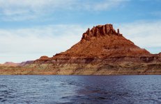
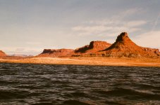

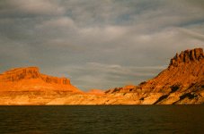

That is so cool. Analog is the way to go sometimes!!Peter has been using his old camera on some of our trips lately. Kinda fun to see these in this day and age. A few more of our recent trip. All on 35mm
View attachment 31405View attachment 31406View attachment 31407View attachment 31408View attachment 31409

dallas massie
Escalante-Class Member
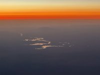
The second picture is Dungees Island out of the water?Peter has been using his old camera on some of our trips lately. Kinda fun to see these in this day and age. A few more of our recent trip. All on 35mm
View attachment 31405View attachment 31406View attachment 31407View attachment 31408View attachment 31409


Jan Hertzen
Well-Known Member
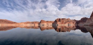
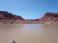
Wow. Silent.Escalante - April 8, 2025 Elevation 3,558
View attachment 31947

Joe Wilson
Well-Known Member

JFRCalifornia
Keeper of San Juan Secrets
Four-Mile Canyon?

Joe Wilson
Well-Known Member
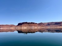
I'll have to look at my graph this afternoon, it could be, but I was thinking it was Two-Mile. We almost made it around the Horn and turned around when we were consistently seeing debris and the graph was reading 5-6' depths. I took this picture on our way back down.Four-Mile Canyon?
JFRCalifornia
Keeper of San Juan Secrets
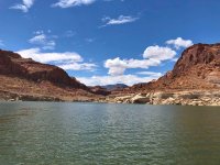
Interesting about the depth. I was guessing Four Mile because I took nearly the identical shot last August (and it was definitely in Four Mile), only the lake was at 3581 at the time. Here's that photo...I'll have to look at my graph this afternoon, it could be, but I was thinking it was Two-Mile. We almost made it around the Horn and turned around when we were consistently seeing debris and the graph was reading 5-6' depths. I took this picture on our way back down.
Joe Wilson
Well-Known Member
It very well could be Four Mile. I know we had gone up past Two Mile and we almost made it to Trachyte but the debris was more becoming more frequent and the depths mentioned earlier. I turned around and took the picture on the way back down lake and don't remember how far back we had gone before taking the picture. One of the guys with me pointed out the view and I thought it was picture worthy (I'm horrible about remembering to take pictures and this one just stood out as a must, haha).Interesting about the depth. I was guessing Four Mile because I took nearly the identical shot last August (and it was definitely in Four Mile), only the lake was at 3581 at the time. Here's that photo...
It is strange that the water level looks really close to the same in both pictures. And looking closer at the two they do look almost identical, other than the snow in mine.


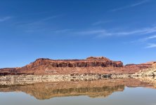

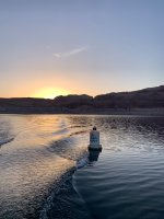
Joe Wilson
Well-Known Member
Well, I am going with Four Mile. My chart reset the current track near Forgotten on the way back down lake so I have no way to verify exactly where I took that picture.I'll have to look at my graph this afternoon, it could be, but I was thinking it was Two-Mile. We almost made it around the Horn and turned around when we were consistently seeing debris and the graph was reading 5-6' depths. I took this picture on our way back down.
JFRCalifornia
Keeper of San Juan Secrets
If you took your photo with an iPhone, you can always click on the information tab for the photo and it will show you exactly where you took it…Well, I am going with Four Mile. My chart reset the current track near Forgotten on the way back down lake so I have no way to verify exactly where I took that picture.
Last edited:
Joe Wilson
Well-Known Member
No iphone, it was an android.If you took your photo with an iPhone, you can always click on the information tab for the photo and it will shown you exactly where you took it…

RichieW13
Well-Known Member
Android should also save location data, if you have the option turned on. (Possibly depending on phone manufacturer?)No iphone, it was an android.
- Open the photo on your Android device
- Swipe up on the photo, or click the 3 dots in the upper right, and it will show additional info, which will include a map and the GPS coordinates

Joe Wilson
Well-Known Member
Yep, mine is most definitely not turned on. Ever.
dallas massie
Escalante-Class Member
- Status
- Not open for further replies.