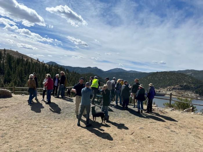
BRC's Fill Lake Powell Project

Question???Does 3588 rise to the ferry ramp on the BF side?? It would on the HC side - does UDOT have any interest to promote/protect operations??? If they would use the extended Exec ramp at BF - What a zoo that would be - again!!!

Here's your answer: The ferry does not operate when the lake drops below 3575. See the link...

 
Here's your answer: The ferry does not operate when the lake drops below 3575. See the link...


Good thought, but not really the answer... The ferry continues to operate after both the HC and BF dedicated ferry ramps are high and dry by moving to the main HC ramp and the BF executive ramp. This really complicates the normal use of those two ramps. It'd be nice if the minimum level were high enough to make the dedicated ferry ramps usable.
 
the question is why wouldn't the udot side with us on the minimum lake level maintenance
I think they are definitely an interested party. It'd be great if they could be motiviated to take a strong position. @scubatim's question about the level being sufficient to operate the ferry on its own ramps is especially timely as the group seeks to establish the desired minimum elevation.
 
Question???Does 3588 rise to the ferry ramp on the BF side?? It would on the HC side - does UDOT have any interest to promote/protect operations??? If they would use the extended Exec ramp at BF - What a zoo that would be - again!!!
The permanent ferry ramp? No. That ramp needs A LOT of water. I haven't seen the ferry operating from the concrete BF ferry ramp operating anytime in the last 10 years when we have been there. I believe the highest water level we have seen over that 10 years has been about 3620. They have been entirely dependent on the exec ramp with the ferry dock relocated to the end of the ramp. It hasn't been that big a deal though, as far as I have experienced, since they tuck it to the side of the ramp, keeping the ramp largely open for launching and keeping those waiting to use the ferry elsewhere and off the ramp.
 
The bathymetry data shows the end of the concrete on the Bullfrog side between 3,599' and 3,615' of elevation. When I walked around the area in 2019 it was apparent that they had done a lot of earth moving to maintain access to the ferry ramp (turned the existing gully into a trench). The ramp was far from the water at about 3,570', with a good quarter mile of soft mud before water. They would also need to have enough extra water to provide draft for the ferry.

It would probably be easier to build a new ferry ramp for the north side in Stanton Creek, and extend the existing ramp in the same gully on the south side.
 
Hey, this is Ben, Executive Director for BlueRibbon Coalition. We settled on this number because it left the vast majority of the main recreation facilities online. We saw value in having a number that boils down and emphasizes the recreation interests on the lake. It certainly could have been other numbers, but 3588 does allow us to define an interest around a certain lake level that is focused on recreation instead of power generation or dead pool. Of course, since this is water management in the West - and Lake Powell in particular - it gets complicated from there. If it is the case that water allocations and the factors that influence them will likely be in flux for the foreseeable future, we wanted the discipline of starting from the point of what we want. How this discipline informs what happens if lake levels drop below this level could take a variety of different shapes, but we want to be part of the discussion, and we think the discussion should be happening sooner than what is happening now. It would have been easier to have made 100 small decisions to rip off bandaids over the years, than the amputation-level treatments that are coming online as I write this. So the 3588 number is an intellectual exercise, as much as a policy position, as much as an actual level of the lake that gives access to real infrastructure and experiences. Hopefully cultivating this solution creates a space where the recreation users of the lake, who many cases area also the consumers of its water somewhere along the line, can be a productive and solutions-oriented force.
Welcome Ben. I appreciate your inputs
 
I'm neither a lawyer nor a politician, just a numbers guy. So I have nothing to say about the legality or politics of getting to 3588. But the hydrology ... hoo boy! According to the USBR's May 2021 hydrology study, Powell stored 10.615 MAF at the end of November 2020 when it was last at 3588. https://www.usbr.gov/uc/water/crsp/studies/24Month_05.pdf. According to the most recent 24-month study (April 2022), forecasted storage 2 years from now will be 4.916 MAF at the end of March 2024. https://www.usbr.gov/uc/water/crsp/studies/24Month_04.pdf. So to get to 3588' two years from now would require having 10.615 - 4.916 = 5.699 MAF more water in Powell than currently projected. And to do that would require holding back not just 5.699 MAF of releases, but a additional amounts to account for bank storage and increased evaporation at higher lake levels. But for simplicity, I'll ignore those.

So what happens to Lake Mead if Powell releases go down 5.699 MAF? That same April 2022 USBR study forecasts March 2024 Mead storage as 7.245 MAF. Take away 5.699, and you've got 1.546 MAF in Lake Mead. That's less than 1/5 of the current 8 MAF in Mead. I don't need to be a lawyer or a politician to tell you that's never going to happen.

Bottom line: you can spend all the time and energy you want talking about 3588', but it ain't gonna happen unless the rain gods change their ways. Or the Upper Basin states stop using water. And I haven't read anything yet in this thread about how to accomplish either of those two things.
 
The bathymetry data shows the end of the concrete on the Bullfrog side between 3,599' and 3,615' of elevation. When I walked around the area in 2019 it was apparent that they had done a lot of earth moving to maintain access to the ferry ramp (turned the existing gully into a trench). The ramp was far from the water at about 3,570', with a good quarter mile of soft mud before water. They would also need to have enough extra water to provide draft for the ferry.

It would probably be easier to build a new ferry ramp for the north side in Stanton Creek, and extend the existing ramp in the same gully on the south side.
The project page for the ferry ramp extension says ferry operations at the terminal terminate at 3,610' (https://parkplanning.nps.gov/projectHome.cfm?projectId=65404). They are planning on allowing operation of both ramps down to 3,555' by shifting the ferry road and ramp to the south on the Bullfrog side and extending the Hall's side down the cove further into the water. EA comments closed in 2016, so I am not sure the status. Seems like they would be waiting for funding. No time like the present for doing the work though, considering everywhere they would want to work is currently dry.
 
Bottom line: you can spend all the time and energy you want talking about 3588', but it ain't gonna happen unless the rain gods change their ways. Or the Upper Basin states stop using water. And I haven't read anything yet in this thread about how to accomplish either of those two things.
It is true that the only ways to raise the lake level to 3588 (or any level above what it is now) is more precipitation upstream, or less use of the water that's there. Or a combination. That's it. If the goal is a sustainable and viable Lake Powell, I think you start with a target elevation, then figure out a path to get you there. Precipitation is largely out of anyone's control. It will happen when it happens. But water use is a controllable variable. And in simple terms, that means either increasing supplies from other sources, or reducing demand. Or both. Is that possible? Sure. Does that require intestinal fortitude and hard decisions on the part of everyone involved in the watershed? Of course. But if there's a path that seems fair (or equally unfair) to all parties, that's the way to go.

Now it's important to realize that making the lake rise is something like paying back a loan. You can't pay it off in one year, and there will be setbacks along the way. But you can start by figuring out what it takes to--on average--create a net surplus in the system each year, and work within those boundaries. The current allocation system doesn't do that. It never did. When the collective water use in the entire Colorado River watershed among the seven states has NEVER been more than 12.59 maf in any given year (and that was in 2001), and water storage trends downward over time, then you know a Compact predicated on at least 15 maf being available to those states is not realistic and never was. And of course, Mexico gets a share too on top of that.

It is instructive to know that in the years that Lake Powell was originally filling, collective water use was relatively low. Until 1986, collective water use among the states was never more than 10 maf, and sometimes less than 9 maf (with one exception: 1974 at 10.04 maf). And that seemed to be a formula to help the lake rise in those years.

It is important to think in the collective interest of the states, not their individual interests, if this is ever going to get sorted out. Otherwise, the bickering and sniping among the states, assigning blame, focusing on the past, will scuttle the entire process. But the good news is that in general, collective water use has generally declined in the past 20 years. Slightly. From that peak of 12.59 maf in 2001, it's settled into a fairly stable 11 maf +/-. And yet that still seems like too much in the long run when balanced against the likely input in the future. Is it possible to get back to the water use of the 1970s and early 1980s from this source? Given that we now know other ways to create water supply options that we did not know then, perhaps it can be done.

So you figure out a flexible system where all equitably share the pain in bad years, or reap the benefits in a good year, while leaving enough behind to let the waters slowly rise... which will take time...

That's the concept. In another thread, I suggested one way to get there. I'm sure there are others. Let's figure this out...

 
Last edited:
The project page for the ferry ramp extension says ferry operations at the terminal terminate at 3,610' (https://parkplanning.nps.gov/projectHome.cfm?projectId=65404). They are planning on allowing operation of both ramps down to 3,555' by shifting the ferry road and ramp to the south on the Bullfrog side and extending the Hall's side down the cove further into the water. EA comments closed in 2016, so I am not sure the status. Seems like they would be waiting for funding. No time like the present for doing the work though, considering everywhere they would want to work is currently dry.

Thanks for posting that info! So glad that this is being addressed! If you've ever tried to launch or retrieve alongside the docked ferry, you know it's an adventure. The ferry engines are used to hold the ferry in place while loading/unloading - creating all sorts of unexpected currents on the rest of the ramp area.

Edit: just caught the part about 2016. Hopefully, this will resurface as part of the overall changes necessary on the north end of the lake.
 
Bottom line: you can spend all the time and energy you want talking about 3588', but it ain't gonna happen unless the rain gods change their ways. Or the Upper Basin states stop using water. And I haven't read anything yet in this thread about how to accomplish either of those two things.
Only the upper basin states? It seems if there was not so much water released out of Lake Mead, that would also keep the level up. Why should only the upper basin states curtail use? I realize none of this is going to happen :)
 
Thought the gang would like to be kept abreast of one of the many diversions of water from the Western Slope to the Front Range (east side of the Rockies where all of the development is taking place).
Note... Gross will be the largest dam in the state exceeding that of Blue Mesa and Navajo.

 
Thought the gang would like to be kept abreast of one of the many diversions of water from the Western Slope to the Front Range (east side of the Rockies where all of the development is taking place).
Note... Gross will be the largest dam in the state exceeding that of Blue Mesa and Navajo.

the divide

Gross Res. is East of the divide. Does it get water from West of the divide? Sq
 
Gross Res. is East of the divide. Does it get water from West of the divide? Sq
Off of Wikipedia.
The reservoir receives water from the western side of the Continental Divide through the Moffat Tunnel.
The proposed expansion of Gross Reservoir would allow Denver Water to store 77,000 additional acre feet of water, drawn mostly from the Fraser and Williams Fork Rivers.[3] Construction on the project, expected to be complete around 2025, will raise the level of the dam by 131 feet (40 meters), resulting in an additional 77,000 acre-feet (95,000,000 cubic meters) of water storage capacity in the reservoir and making it the tallest dam in Colorado.
Good get!!
 
I should have known that, back in the day (70’s & 80’s) I was a member of the “Rollins Pass Restoration Association”. Sq
 
Back
Top