
You are using an out of date browser. It may not display this or other websites correctly.
You should upgrade or use an alternative browser.
You should upgrade or use an alternative browser.
Blue notch
- Thread starter stickbow shooter
- Start date
- Status
- Not open for further replies.


Paladin
Well-Known Member
Good work Dave!!For those who have never experienced the muck. It will get ya if you get into it.
View attachment 16712
Keep it up.
Imagine: all of this just to go fishing.
Good hearts; best wishes to all of the stuckees!

Dave I.
Escalante-Class Member
More pictures please. Sq
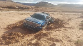
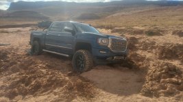
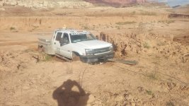
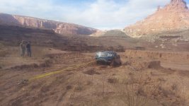
I do hve more pictures but they are scenery for my wife and really don't show the conditions or the rescue. Just the pretty drive in and out.
But the good news is the road has been freshly motor graded so it's really not bad until you get to the location we were at. In the rocky areas, there are several rocks in the road though, but small enough to move by hand.

The coordinates were: 37.7219, -1104445 Just in case anyone wants to see where this "bad spot" is located

Dungee
Keeper of San Juan Secrets
View attachment 16717View attachment 16718View attachment 16719View attachment 16720
I do hve more pictures but they are scenery for my wife and really don't show the conditions or the rescue. Just the pretty drive in and out.
But the good news is the road has been freshly motor graded so it's really not bad until you get to the location we were at. In the rocky areas, there are several rocks in the road though, but small enough to move by hand.
The coordinates were: 37.7219, -1104445 Just in case anyone wants to see where this "bad spot" is located
Is this area past the steep hill and where the road starts diverging a bunch of different ways?
Dave I.
Escalante-Class Member
Yes it is. It is on the other side of "The Pyramid"Is this area past the steep hill and where the road starts diverging a bunch of different ways?

jayfromtexas
Well-Known Member
Thanks for sharing that location. Wow they were pretty close to the water and a long way in.

Todd
Escalante-Class Member
Let’s go!Todd, I texted Dave the same thing yesterday. I haven’t been down Blue Notch before. Sq
Dave I.
Escalante-Class Member
If I knew you were headed down I would have met you from bullfrog
I left Hanksville at 8:30 am and then got home about 5:30 pm.Todd, I texted Dave the same thing yesterday. I haven’t been down Blue Notch before. Sq
The wife was surprised I made it back the same day. On trips like this, I'm always packed to stay in the truck if needed.
Definetly worth a camping/hiking trip to explore. We weren't even close to the water though to go fishing or boating.
I looked it up on Google Earth and I think they were even farther in than the coordinates judging from the pyramid location. Once past the pyramid, it was probably about 10 more minutes of driving.Thanks for sharing that location. Wow they were pretty close to the water and a long way in.
My GPS said they were 16.8 miles in off the Hwy but once the blue notch road hit the gps waterline, it just made a straight line to their coodinates they sent. Never set the odometer.
I have hit my maximum # of posts for a 24 hour period. See ya in the am! haha
Last edited:
WOW,,,,,,,, that is not a good day!!!!For those who have never experienced the muck. It will get ya if you get into it.
View attachment 16712
jayfromtexas
Well-Known Member
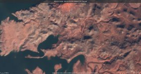
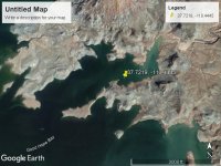
Dave I.
Escalante-Class Member
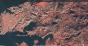
That is a much better picture of where this was. Blurry, but much better. Thanks Jay! Awesome find.Squirrel, here's a more up to date image from EO Sentinel. And one from Goggle Earth. Been underwater for sure not that long ago.
Jay
The red "X"Is where the truck was stuck.
The blue "X" was the high, dry ground "target to get every truck to for safe exit.
The yellow line shows the route we needed to travel between the 2 'X's
Keep in mind, one guy in the group had a range finder and, "as the crow flies", the distance between the red X and the blue X was 330 yards (990 feet). This will give a scale to anyone that wants to figure out the waters edge from any location on this picture. Awesome info for anyone wanting to figure out current Blue notch conditions if they find a current picture.
Thanks Jay! I'm sur ethis will help many make (or break) a Blue Notch trip
jayfromtexas
Well-Known Member
Glad to help Dave! Love the EOS site. From the photos did they get stuck crossing the wash?That is a much better picture of where this was. Blurry, but much better. Thanks Jay! Awesome find.
The red "X"Is where the truck was stuck.
The blue "X" was the high, dry ground "target to get every truck to for safe exit.
The yellow line shows the route we needed to travel between the 2 'X's
Keep in mind, one guy in the group had a range finder and, "as the crow flies", the distance between the red X and the blue X was 330 yards (990 feet). This will give a scale to anyone that wants to figure out the waters edge from any location on this picture. Awesome info for anyone wanting to figure out current Blue notch conditions if they find a current picture.
Thanks Jay! I'm sur ethis will help many make (or break) a Blue Notch trip
View attachment 16743
Dave I.
Escalante-Class Member
They were actually trying to travel down thru the wash. One truck got stuck where we pulled out of. That "s" curve is distictive and there are SEVERAL wet spots that will stick ya.Glad to help Dave! Love the EOS site. From the photos did they get stuck crossing the wash?
When I stopped to winch them out, my truck actually sunk (sorry, no pictures) just from the movement/vibration from the winch. No tires spun and I was bumper beep in the semi-muck in the wash.
it is no joke when you get that far in.... For a 6000 pound vehicle, it's worse than 1960's sit com scenerio "quick sand". You get into it, give me a call!

Dave I.
Escalante-Class Member
2x times actually! I actually decided the only way to get these guys out was to risk getting myself stuck also.Dave were you stuck bad enough to have to get your self out first?
Stuck #1 was just soft soil/sand/muck where I stopped in down in the wash. Felt soft driving in but didn't sink at first. Once the winch started to work, the trucks front right tire sunk in pretty bad. Since Ken's truck was more stuck than mine, we reversed the rolls, got my truck onto solid ground and continued the rescuse and got his truck out.
Stuck #2 was anticipated. They had 2 trucks on dry ground. This was the ONLY factor that contributed to my decision to go down with my truck into the wash!!!!! Once both trucks were free, I knew neither truck would make it out of the wash on it's own. I made a run for it, knowing I would get stuck. This was also no surprise to anyone in the party. We ALL expected this. We then used both trucks on the dry ground to get my truck out. . Once out, we used my truck to get Ken's truck out.
Like I said before, this was a unique effort in getting everyone out safely. It was truely a team effort on everyone's part.
Not to toot my own horn, But I think I am the ONLY tow company that will willing put their equipment in harms way to get the job done. I went down iinto that wash knowing I wouldn't get out without their help.
I guess that is just the coal miner in me. Get it done, go home or die trying.
Dave I.
Escalante-Class Member
More pictures please. Sq
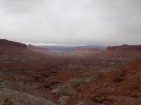
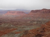
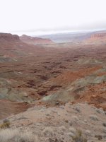
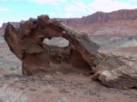
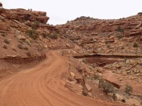
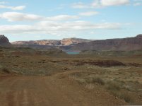
These are for all the people who haven't been to Blue Notch. I'm not a professional photographer, so please be gentle.

After you leave Hwy 95 you'll look at the bluffs and wonder how the road even goes up them. It is a beautiful drive full of switch backs. Recently graded and VERY dusty right now
Then in 2.5 miles you are at the ridge. It is a must stop the first time your there to take in the views. You get an unobstructed view on both sides of the road. This is where the "big view" pictures were taken, but of course, the camera doesn't do it justice.
Once you start up again, you have some rocky, cliff roads for a mile or 2. Like I said, the road was recently graded so it wasn't to severe right now, but my feeling is this is not a part of the road you would want to be on while a good rain is happening. It is obvious this is a high drainage area. Right now, it is very easily passable.
Then you get down into the bottoms. You cross the wash several times. I think I counted 6 crossings. No rain/water right now and completely passable. Of couse, water could change all that very quickly.
The only spot where I felt the need for 4x4 this trip (just the drive down, not the rescue) was over the steep hill down by the original waters edge. It is steep but any decent 4x4 with good AT tires can do this little obstacle. If you're not sure how the road goes, you will need to get out and look at the crest because you cant see the road over your hood. There is a small curve to the road here but be careful and you'll be fine
It's too bad this is a National Park. It would be illegal for me to fire up the drone, put it in "follow me" mode and show some of the obstacles that way. Because, like the barneys said, there is a lot of air traffic and there are dangers of flying a drone in the park and that is why they are illegal. Just being a little facetious there.
In the last picture, I got to see the lake. Never made it there, but I did see water! haha

Rainbowbridge
Keeper of San Juan Secrets
Great pics, many thanks! At the risk of being politically incorrect.....
BREAK OUT THE DRONE!!!!
BREAK OUT THE DRONE!!!!
- Status
- Not open for further replies.