So I’m thinkining a minimum of a bow line and two 45 degree stern lines for mooring the 19’ powerboat. How far up to the shore should I keep the bow for mooring? And how do you prevent wind from pushing it too far up on shore? Just curious if I’m missing something for the best way to do it! Thanks again, and yes, I’m sure I’ll be coming back again and again. It’ll be great getting all of these tips and tricks under my belt. I’d rather learn BEFORE the first time we’re out there.
The short answer...don’t worry about it.
The long answer...
With your 19 footer‘s low freeboard, there’s not much worry of being beached on a steep enough beach. My “test“ was 20 years ago with a heavy 30’ cruiser. Impending darkness, scarcity of suitable campsites and three dogs aboard led to being moored on a beach with too shallow of a slope. Heavy overnight winds/waves on the stern left us stuck tight in the morning. The “lesson learned” for my boating setup? It’s a pain, but with only shallow sloped beaches abailable for a campsite, I now anchor out in open water and use the SeaDoo to ferry the dogs to shore for nature’s call. In May, unless you’re talking Mem Day here, you’ll have ample good beaches to choose from. If it’s crowded and you see an apparent ”perfect spot” someone has overlooked, check it out for slope before you beach. Probably more of an issue in May is the need to daily tighten your lines as, hopefully, the water level will be rising.
Unfortunately, Treetop’s statement re “the test coming before learning the lesson”.....too often is true. (The corresponding saying in aviation circles is similar.... “Experience is a great teacher!....Unfortunately, it kills a few students...”) The bright side, if there is one? The lessons learned the hard way, assuming you survived and the only pain is to your ego and wallet, remain more deeply ingrained in your brain than the knowledge gained from just reading a caveat. Having said that, I think a sticky thread here titled “I learned from that“ or probably more appropriately, “never again” , would not only be good for a few grins and groans, but hopefully also beneficial for anyone seeking to acquire less painful Lake Powell wisdom. I know it would have been helpful for me when I started out. I now hate to admit my Powell inauguration. I set out 25 yrs ago with my wife, three kids and a dog to explore Powell. I had little/no boating experience, bought a used 27’ cruiser, had a fresh completion certificate from the USCG boating course, a Stan Jones “boating Lake Powell map“ along with a Garmin portable aviation GPS that had marine software and would accept a high definition Lake Powell card, some advice from a couple friends and blind courage. In retrospect, judged by lack knowledge so easily accessed today, crazy. The GPS only had full pool resolution, but for 1995, that was close enough....not true today. My knowledge of anything Wayne related in those days came from glancing at the daily copy of the Fishing Report posted on the bulletin board at the DR ranger station when we went for gas, ice and the famous Dangling Rope ice cream Cone ($1.00 back then...and better ice cream) The internet knowledge base was still in it‘s infancy. When I did find the precursor to this website, it was mostly lurk and learn from the old salts who had known the lake from the completion of the dam and had much entertaining advice to share.
Needless to say, I have had a few “never agains” etched into my brain over the years. I would suggest searching the recreation side of the board also for more tips on safely boating this lake. There are pages of info. One of the biggest dangers is just below, or barely above, the surface. Over the years I’ve learned to avoid most of these lurking obstacles, but still plan to add one of the apps (Navionics) to my phone and iPad that allow for water level adjustment to see near current lake shoreline and hazards. Large wide open bays can harbor the tips solid rock pinnacles waiting to test your fiberglass....so far from shore you would never expect it. They are commonly called whales on this site. Safest travel, especially with any speed, is with the sun high in the sky, polarized glasses on, and all eyes on the lookout for the greenish yellow water that marks these underwater rocks. Use extreme caution when cutting sharp bends. When I was camped years ago in Reflection Canyon, I found a 42 ft cruiser resting 100% out of the water on rocks that were jutting way out from a sharp bend. The driver was physically unharmed, only ego bruised when we offered help. Follow the ATONs which are only found in the main channel. (historically in recent years these are not well maintained.) In the side canyons/bays there are no official markings. If you see a floating gallon milk jug, be careful if you think you’ll pick up a piece of floating trash...it has usually been placed by another boater to mark a hidden hazard.
These bits of advice could go on and on, so I’ll spare you. Search is your friend and I’m sure the list of caveats will grow here.


 www.slideanchor.com


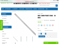


 ) and make yourself three 100’ lines. It’s very easy with 3 strand nylon to weave a nice eyelet in one end and slip a nice section of 1” heat shrink over the other end, then shrink it and melt the stub to prevent un raveling. For dock lines, you can buy two 15‘ 1/2“ braided lines at Wally World with eyelet already woven for so little that it’s not worth making your own. Here’s a link to the example for the spool of rope. Click away...I have no affiliate deal going with Lowes. HD has about the same stuff.