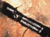
So Weeds, in your considerably esteemed opinion, are those weights working like they should? (Then or now?)
Seems to me that it’s very odd that they would be on the shore??!!
Have no clue Gem.
Those barrels weren’t that close to the shore, seems like maybe 20 ft away. It’s been 8 years since I took those photos…and I haven’t been to the lake in 4 years. Did spend about 11 years there…one at dry storage and 10 (2008 to 2018) on the slip…an outside slip facing the NE wall.
We did a lot of “dock potatoing” and saw a ton of amazing activity off our stern…beyond the usual 30mph speeds thru the No-Wake zone thing.
Anyway those cables were/are a mystery to me. I would think it would take an engineer with a lot geometry, strength of materials, and math skills to figure out how to put it all together…and then maintain it
In the beginning all I was thinking about was lateral displacement of the entire dock, including the restaurant, fuel dock, rental boats dock…and the personally owned boats dock. Never thought about what was involved with the water current flowing toward the dam.
The vertical displacement from the lake going up a foot a day shouldn’t be too much a problem (remember those days?) But if the lake went up 50 ft in a few months, there might be some kind of stress on the cables…depending on the wall attachment points. (The opposite problem of today)
All along the docks are large reels with the cables wound around them (photos). There must be several hundred...probably over a thousand…(that’s a W.A.G.)...cables and reels all over the full length and width of the docks. Don’t forget the other SE wall has cables too. Fairly often 2 or 3 guys would be out there reeling those things tighter or less so. Usually the walkway dock sections were not heading in a straight line and they would adjust things until they did. But what gets me is those cables from the reels are vertical to the dock…going straight down into the water. I wonder how far they go down until the cable direction is changed toward the canyon walls…can’t go too deep, but must be deep enough so the cables wouldn’t interfere with the surface. And how is the direction change accomplished...pulleys?...attached to what under there? I’ve seen several Navajo Nation scuba divers around doing whatever they do. Those cable workers and divers seem to be a cut above the average bear and I’m sure well compensated.
Just cannot imagine what it looks like below the docks with the massive menagerie of cables running everywhere.
Thus far they seem to take care of it all.
Probably should have a

lot of warnings to hug the houseboat side….plus flags or something on the exposed cables next to the walls.