
You are using an out of date browser. It may not display this or other websites correctly.
You should upgrade or use an alternative browser.
You should upgrade or use an alternative browser.
Coyote Bridge
- Thread starter JohnJr
- Start date
- Status
- Not open for further replies.
Dillonwhitt
Active Member
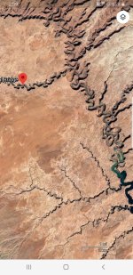
If you look at it on Google earth and measure. it says if you could walk a staight line north then take a left when the wash opens up and walk straight to the arch it's a little over 8 miles.. now with all the twist and turns of the river I'd say double if not triple that... I hope this post get alot of comments this is on my lake Powell bucket list to do also. I've rode horses down to the arch looking for cows but never came up the lake side. my dad and uncle said they tried to go from the arch to the water back in the 80s a few time and they don't think it's possible. I think someone with hiking shoes and a little determination could make the hike over some cow boys so I'm planning to prove them wrong this fall..
Attachments
Last edited:
Tiff Mapel
Escalante-Class Member
I've been going to Powell for over 30 years now, and I STILL haven't done that hike. Here's the problem with June, though. The water will still be coming up. The end of the Escalante is notoriously choked with debris at that time of the year. Not good for those jet ski engines when you suck a stick into your impeller. Bring some waders and prepare to get muddy. And then definitely share pics of your adventure!
Tiff
Tiff
Powelldreamer
Well-Known Member
Does anyone have any pictures of this wondrous sight? Now I want to attempt this. I am more inclined to do so in receding water, more like early fall. Either way you need to be mindful of the regional weather when you make the attempt.
Gem Morris
Keeper of San Juan Secrets
Stevens Arch aka Skyline Arch is a shorter hike and also very worthwhile. You can see it from the confluence of Coyote Gulch and the Escalante River
Gem Morris
Keeper of San Juan Secrets
I
If you pick your way carefully up the scree slope you can hike directly into the arch - it’s way coolWe will try that instead of going all the way to Coyote Bridge. Thank you!
Dillonwhitt
Active Member
it's worth going to. maybe try hiking from land first.
JFRCalifornia
Keeper of San Juan Secrets
I’ve hiked to the Escalante River down Coyote Gulch via Hurricanes Wash from Hole in the Rock Road. That’s about 13 miles each way, and call it 11 to Coyote Bridge. A fantastic backpack trip. You’d also see Jacob Hamblin Arch along the way, which is even more impressive.
From the lake,you won’t get any farther than Explorer Canyon (10 miles from the mouth of the Escalante) before you have to walk. As others pointed out, the challenge will be getting past logs and mud where the lake ends. From there it’s about 8 miles or so to the mouth of Coyote Gulch, then another 2 to get up to Coyote Bridge.
I would love to try this someday, but it’s not a casual walk in the park...but worth it I’m sure!!
Gem Morris
Keeper of San Juan Secrets
I’ve done that plus a little bit adding boat and truck. The biggest part was the “orchestration” to make it all happen with about 20 boys and various modes of transportation.I’ve hiked to the Escalante River down Coyote Gulch via Hurricanes Wash from Hole in the Rock Road. That’s about 13 miles each way, and call it 11 to Coyote Bridge. A fantastic backpack trip. You’d also see Jacob Hamblin Arch along the way, which is even more impressive.
From the lake,you won’t get any farther than Explorer Canyon (10 miles from the mouth of the Escalante) before you have to walk. As others pointed out, the challenge will be getting past logs and mud where the lake ends. From there it’s about 8 miles or so to the mouth of Coyote Gulch, then another 2 to get up to Coyote Bridge.
I would love to try this someday, but it’s not a casual walk in the park...but worth it I’m sure!!
Hurricane Wash, Coyote Gulch, Escalante River to Lake Powell, a few days boat camping, then on by boat to Hole-in-the-Rock, up to a waiting truck and back to Hurricane Wash. A “loop”. It was epic. The “boys” still talk about it 20 years later whenever I see one of them

JFRCalifornia
Keeper of San Juan Secrets
That sounds fantastic...those guys are lucky!I’ve done that plus a little bit adding boat and truck. The biggest part was the “orchestration” to make it all happen with about 20 boys and various modes of transportation.
Hurricane Wash, Coyote Gulch, Escalante River to Lake Powell, a few days boat camping, then on by boat to Hole-in-the-Rock, up to a waiting truck and back to Hurricane Wash. A “loop”. It was epic. The “boys” still talk about it 20 years later whenever I see one of them
Gem Morris
Keeper of San Juan Secrets
Coyote Gulch is not a "slot canyon" per se. You still need to pay attention to the weather forecasts and take the normal precautions. But there is NO WAY you'd get an unexpected rise of 20 feet of torrential flood in Coyote Gulch. I'd think 5' would be a 500 year flood. And there are plenty of places to get "up and out" of the way.
- Status
- Not open for further replies.