Raven Haven
Well-Known Member
Hello WWers!
My girlfriend Mary and I took a Spring Break trip from SoCal to southern Utah in late March/early April. After many years of wanting to explore Bryce, Escalante GS, and Capitol Reef, we finally made it happen. Scenic Byway 12 didn't disappoint, nor did hiking in Bryce on a beautifully sunny day after a snowstorm dropped a couple of inches the night before. But the highlight of the trip was definitely the Hole in the Rock road. Like most of you, I have been to that area many a time by boat and Google Earth, but the remoteness of the Escalante Canyons via road is still so amazing.
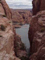
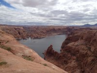
After somewhat reluctantly leaving Bryce and making a quick detour to Grosvenor Arch and Kodachrome, we rolled into Escalante. We still had daylight so we went to Devil's Garden and got some good sunset photos of the hoodoos and Metate Arch. Early the next morning, our plan was to take my FJ Cruiser all the way to the end of the 56-mile Road and then do some exploring and hiking of a couple of canyons on the way back up. Of course, I knew we would only see a tiny portion of all the places I hope to someday see. The Road itself was in very good shape, although the last 6 miles did require a little bit of high clearance. I would not recommend a standard passenger vehicle doing the last 6 miles. Nobody was at the end of the Road when we arrived, nor did I see any boaters. What views from the top of the Hole! I'd been there before by Lake but it was cool to get there in my FJ. Last year I took a group of Trash Tracker volunteers to the Hole so they could hike to the top. After a few pics, we walked up to the NE side of the ridge to get a great view of Cottonwood Canyon and the Lake below. Surprisingly (nighttime temps were in the low 30s), we saw a baby rattlesnake curled up taking in some sun. We (carefully) hiked around for another hour or so looking for Everett's 1934 journal (sorry Tiff, didn't find it).
So many choices as to where to stop on the way back to Escalante. I was particularly interested in Davis Gulch, but after some discussion we decided that Davis would have to wait until we had more time to fully explore the area. I'd like to search for the bronze plaque dedicated to Everett as well as the purported "NEMO 1934" inscription located somewhere above the south rim of Davis towards Clear Creek.
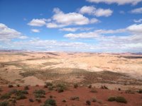
Mary's next choice to hike was Steven's Arch. Along the way, we stopped at some caves at the base of Kaiparowits Plateau, Dance Hall Rock (and a quick bocce match), and a scenic overlook heading up a side road towards the Plateau. The hike to Steven's Arch was spectacular. Standing at "the Crack" with an amazing panorama of the Escalante and Steven's is hard to describe while sitting here in my classroom (not to worry, my kids are taking the State Test)! Even the photos don't do the view justice. The sun was setting on our daylong journey so we dodged some cows and made it back to the FJ right at dusk. I highly recommend an adventure down the Hole in the Rock Road to all of you Wordlings who are up for a little adventure. We plan on going back for some Davis, Egypt, and Willow Gulch, not to mention all of the eastern canyons into the Escalante. A Final Four ticket awaited Mary and her Gonzaga alum daughter so off to Scottsdale we went. Being a SoCal Lake Poweller, that allowed for my first ever trip to Hite. Interesting. We also managed to do some hikes in Natural Bridges and Hovenweap, as well as a quick stop at Edge of the Cedars to see the Macaw Sash described to me by Trash Tracker Dr. Gulliford. Very cool. One of these days I'll try posting a couple of pics. See you on the Lake soon. Stop by the Trash Tracker if you see us!
Eric


